Phone
0266 312 321
E-mail :

Geopark varies greatly depending on the type of lithology, geological structure, tides, and sedimentation. Rock evidence found in this part shows a shift in the coastline from 7.2 million years ago to the present. These rocks are part of the Cibodas Formation which is composed of limestone, partly tuff, and limestone sandstone. The best outcrop to view these rocks is at Karangbolong Beach and Gunung Sungging Cave.
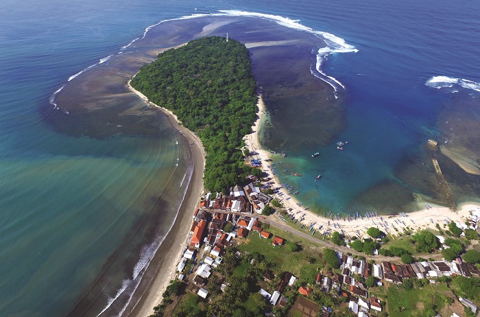
Along the south coast we can find almost similar views, namely dunes- sandbanks with grass meadows. Some of this sand is broken limestone which is brightly colored and some is iron sand, which is dark in color as a weathering product of rocks in the Jampang Formation. In the Surade to Ciracap areas, the morphology of the steep rocky coast is partly eroded by sea water, forming crevices and caves. In Ujung Genteng area, there Tombolo landscape formed by the accumulation of sedimentary materials that unites the island, which was originally separated, into one with the main land. Geosites related to the theme of the formation of new plains in the Southern part of West Java include:
1. Pangumbahan Beach Geosite
2. Ujung Genteng Geosite
3. Mount Sungging Cave Geosite
4. Karangbolong Beach Geosite
Sub-distric Surade [H7]
Sub-distric Ciracap [H2]
Head Office
Address :
 INDONESIA
Ciletuh-Palabuharatu Geopark All rights reserved | Designed & developed by @Kominfo Kab.Sukabumi